

Features getoutdoorsKS
Kansas trail maps for hiking, biking, equestrian and kayaking all in one place!
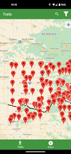
Discover over 4,000 miles of Kansas’ public trails.
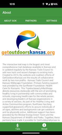
Download this custom app with no in-app purchases or subscriptions, created by Kansans for Kansans through the team effort of Kansas Wildscape Foundation and the Kansas Trails Council.
Locate statewide trail without pop-ups or annoying ads.
GetOutdoorsKansas is designed to be direct, stream-lined and easy to use.
Easily explore Kansas trails with these convenient features:* Find every Kansas trail of every type and permitted use on the only complete trail map that is continuously updated by our trail team.* Follow your progress with GPS capability on the interactive trail feature.* Auto-cache trail maps to explore while off-line.* One touch and easily know the trail’s distance from your location, the length and its permitted use.* Filter trails by hiking, biking, equestrian, motorized and water recreational use.* Search trails by surface type.* Access directions to all trail heads.
* Find current trail information actively monitored and updated by the GetOutdoorsKansas trail team.
* Instant trail rendering using a custom 2-stage WKT parser.
* Innovative card UI detail views.* Search by proximity, activity and costs.* Search by keywords to find trail information.Join us!
Like what you see and want to add your trail info for free?* Report new trail information to [email protected] and we’ll get the GetOutdoorsKansas trail team on it.
Fitness Tracking
Track your workouts and monitor your health metrics.
Travel Features
Plan and manage your travels with ease.
Food & Dining
Discover recipes and order food from your favorite restaurants.
See the getoutdoorsKS in Action
Get the App Today
Available for Android 8.0 and above